User Tools
Sidebar
Table of Contents
Warnings
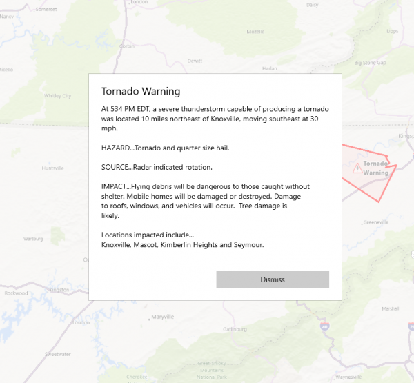
Weather Radar and Alerts provides a user with the ability to view active warnings issued by the National Weather Services. These warnings are drawn onto the map using a Polygon. The warning text can be viewed by clicking the Triangle Icon  in the center of each warning.
The current warnings that can be displayed are:
- Severe Thunderstorm Warning
- Tornado Warning
- Flash Flood Warning
- Flood Warning
Additional advisories and warnings are coming in a future release. These include the following advisories and warnings:
- Unordered List Item
Warning Information
To view information about the warning, click the Triangle Icon  in the center of the warning. A box will pop-up and provide the National Weather Service details about the warning.
Understanding Warnings
Severe Thunderstorm Warning
This is issued when either a severe thunderstorm is indicated by the WSR-88D radar or a spotter reports a thunderstorm producing hail one inch or larger in diameter and/or winds equal or exceed 58 miles an hour; therefore, people in the affected area should seek safe shelter immediately. Severe thunderstorms can produce tornadoes with little or no advance warning. Lightning frequency is not a criteria for issuing a severe thunderstorm warning. They are usually issued for a duration of one hour. They can be issued without a Severe Thunderstorm Watch being already in effect.
Tornado Warning
This is issued when a tornado is indicated by the WSR-88D radar or sighted by spotters; therefore, people in the affected area should seek safe shelter immediately. They can be issued without a Tornado Watch being already in effect. They are usually issued for a duration of around 30 minutes.
Flood Warning
Flash Flood Warning
Issued to inform the public, emergency management, and other cooperating agencies that flash flooding is in progress, imminent, or highly likely.


